
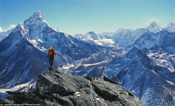
KHEERGANGA

Kheerganga: charismatic grey-green mountains along with the thunderous Parvati river
Kheerganga's landscape and skies are a much-needed delight to the trekker's eyes and especially those almost dead legs.
These mesmerizing views just make the whole hardships of the trek more meaningful.


About Kheerganga Trek-
Approx trekking distance (Both sides): 26 km
The highest point of trek: 10,065 ft.
Nearest Airport: Bhuntar Airport
Nearest Railhead: 150 km
Region: Kullu
Snow: Kheerganga is covered with snow in the winters, i.e from November to January.
Starting point of trek: Tosh
Best time to visit
May - June
September - October
How to Reach Kheerganga Trek
By Air - The nearest airport to Kheer Ganga is the Pantnagar Airport, which is located about 235 km from Kheer Ganga. From here, one can take a taxi or a bus to Barshaini, from where it is only an 11 km trek to Kheer Ganga.
By Rail - The nearest railway station is Kathgodam Railheads, which is about 198 km from Kheer Ganga.
By Road - The route to Kheer Ganga is well connected till Barshaini, after which it's an 11 km trek to reach Kheer Ganga.
General tips and tricks
1. Carry a pair of warm clothes.
2. Always carry First Aid box.
3. Carry raingear as the weather at higher altitude changes anytime.
4. Carry batteries/Power bank for a phone as there may be no electricity supply.
Picture credits: Amneet Singh Arora